
With the maximum penalty for workplace safety breaches reaching RM500,000 under the amended OSHA 1994, the cost of "not knowing" what's happening on your site has never been higher. Traditional manual reporting is no longer just slow; it's a liability that leaves stakeholders disconnected from the g...
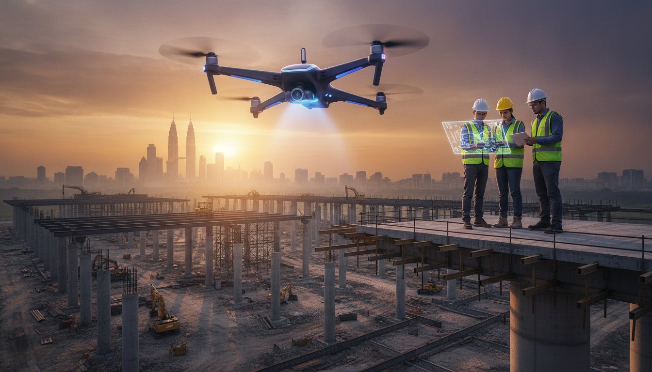
With the maximum penalty for workplace safety breaches reaching RM500,000 under the amended OSHA 1994, the cost of "not knowing" what's happening on your site has never been higher. Traditional manual reporting is no longer just slow; it's a liability that leaves stakeholders disconnected from the ground reality. For project leads across the country, construction project monitoring with drones Malaysia has evolved from a creative luxury into a critical data layer. It's the bridge between abstract site plans and tangible, real-time progress. Vision requires clarity; execution requires data.
You likely recognize that legacy reporting methods struggle to capture the full scale of long-term infrastructure developments or satisfy the rigorous visual demands of ESG documentation. We understand that project mastery depends on total visibility. This 2026 strategic guide explores how drone-assisted monitoring transforms Malaysian construction sites into transparent, data-driven environments. We'll preview the new UAS-TMS permitting landscape, explain the synergy between aerial precision and long-term timelapse, and show you how to translate complex site requirements into high-impact visual narratives that command attention in the boardroom.
• Understand the transition from manual site reporting to aerial data capture to create a transparent, real-time environment for all project stakeholders.
• Learn how construction project monitoring with drones Malaysia enhances site safety by reducing high-risk personnel exposure while maintaining millimetre-level precision tracking.
• Discover the efficiency gap between traditional ground-level snapshots and comprehensive drone overviews that deliver site-wide clarity in hours, not days.
• Navigate the 2026 CAAM and JUPEM regulatory landscape to ensure your infrastructure projects remain fully compliant with the latest risk-based UAS framework.
• Explore the strategic process of transforming raw site data into high-impact visual narratives suitable for board meetings and corporate ESG reporting.
Site transparency isn't a suggestion; it's a standard. In 2026, construction project monitoring with drones Malaysia has transitioned from a niche experimental tool to the backbone of site intelligence. Manual site walks are inherently limited by human perspective and physical constraints. They're slow. They're subjective. They're prone to gaps. By contrast, aerial data capture provides a comprehensive, objective truth that serves as a single source of reality for every stakeholder involved. We don't just record progress; we define it through a lens of absolute accuracy.
The shift is driven by the Construction Industry Transformation Programme (CITP). This initiative isn't just a policy document; it's a mandate for modernization. It pushes for a construction landscape where data is as vital as cement. High-fidelity visual documentation is now a prerequisite for national infrastructure funding, as it ensures that every Ringgit spent is accounted for. We aren't just taking photos; we're building a digital bridge between the ground and the boardroom. Modern drone applications in construction now integrate directly with Building Information Modeling (BIM) workflows. This allows project leads to overlay actual site progress against planned architectural models in real-time. It's a level of "Site Clarity" that traditional reporting simply cannot match.
The benefits of this digital shift extend across the entire project lifecycle:
Stakeholders can inspect site details from anywhere, reducing the need for constant travel.
Every flight creates a permanent, timestamped record of the site's evolution.
Data-driven visuals provide undeniable evidence in the event of contractual disputes.
Technology has reached a critical threshold. Advanced sensors like LiDAR and 4K+ imaging are now standard across major infrastructure projects. These tools provide the "editorial clarity" needed to navigate complex site data. Government-linked companies (GLCs) and multinational corporations (MNCs) now demand this level of transparency to mitigate risk and ensure accountability. In a landscape where efficiency is the only currency, aerial documentation is the gold standard. It provides a perspective that is both high-level and granular, capturing everything from massive earthworks to specific structural details.
This evolution also aligns with the rise of corporate sustainability. Aerial visuals are no longer just for progress tracking; they're essential for ESG video production Malaysia. They provide the visual proof required for environmental and social governance reporting, turning raw site activity into a narrative of responsible growth. By 2026, the question isn't whether to use drones, but how to leverage the data they provide to drive project success.
Modern infrastructure requires more than just oversight; it demands strategic foresight. Implementing construction project monitoring with drones Malaysia provides a dual advantage: operational precision and executive clarity. By digitizing the physical site, project leads can identify potential delays before they escalate into expensive errors. This proactive approach transforms the site from a black box into a transparent, manageable asset. For developers, construction project monitoring with drones Malaysia is no longer an optional upgrade; it is the standard for modern project management.
Safety remains the cornerstone of every successful build. In Malaysia, falls from height account for approximately 32% of fatal workplace accidents. Integrating drone technology in building site safety effectively removes personnel from high-risk environments like tower crane summits or unstable slopes. Instead of manual inspections, high-resolution sensors capture every detail from a safe distance. It's a shift from reactive protection to predictive prevention. We prioritize the preservation of life through the application of precise technology.
Complex organizational messages often get lost in technical jargon. Aerial perspectives simplify this narrative. For GLCs and government bodies, progress videos serve as visual proof of milestone completion. They validate funding and build public trust. We don't just provide footage; we curate a visual legacy for national landmarks. These high-impact visuals are essential for boardroom presentations, where investors need to see the scale of their commitment. If you are looking to elevate your project's transparency, our strategic documentation services can bridge that gap.
A single perspective is never enough for a multi-year development. The true power of monitoring lies in the synergy between aerial precision and fixed-position recording. By combining drone sweeps with long term timelapse Malaysia, we create a 360-degree view of the project's evolution. Drones provide the broad, sweeping context of the site's footprint, while fixed timelapse cameras capture the relentless, granular pulse of daily activity. Together, they form a comprehensive historical record that is invaluable for marketing major developments and satisfying future audit requirements. This integrated approach ensures that no detail is missed and every achievement is documented with cinematic authority.
Traditional site reporting is a game of fragments. It relies on ground-level snapshots, subjective handwritten logs, and the physical presence of engineers. This process is inherently reactive. By the time a report reaches an executive's desk, the site has already changed. In contrast, construction project monitoring with drones Malaysia offers a proactive, unified perspective. It captures the entire footprint in a single flight, turning days of manual labor into hours of digital analysis. Where manual reports offer snapshots, drones provide systems.
The difference lies in the depth of data. A ground-level photo captures a wall; an aerial sweep captures the workflow. This objective high-resolution footage replaces the ambiguity of subjective notes with a permanent, visual record. We move from fragmented glimpses to total site awareness.
Ground-level views are restricted by walls, fences, and geography. Drones remove these barriers. Using aerial photogrammetry, site leads can detect structural deviations that are invisible from the ground. This precision improves communication between site teams and off-site executives, as both parties look at the same high-resolution truth. While there are challenges of drone adoption in Malaysia regarding technical integration and specific weather patterns, the benefit of reducing unnecessary physical site visits is undeniable. We move from guessing to knowing.
Visual data is the ultimate insurance policy. When project timelines are questioned, aerial records provide indisputable proof of work performed. This documentation drastically reduces the time spent on dispute resolution, saving administrative costs and preserving partnerships. Beyond the technical utility, these visuals serve a dual purpose. The same high-resolution footage used for monitoring can be repurposed for cinematic Launching Videos or Montage sequences that showcase project success to future investors. The return on investment is clear. Efficient data collection leads to faster decisions. Faster decisions lead to shorter timelines. Shorter timelines lead to higher profitability. Construction project monitoring with drones Malaysia is the catalyst for this cycle of efficiency.
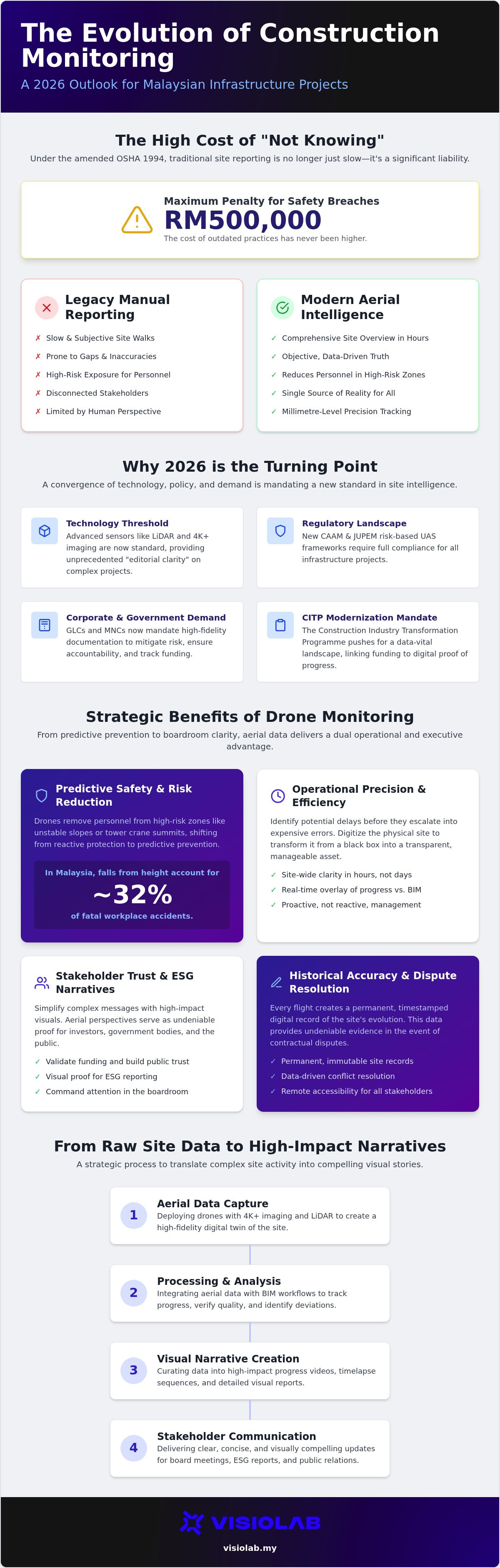
Compliance is the foundation of site intelligence. In 2026, the Malaysian regulatory landscape has matured. The Civil Aviation Authority of Malaysia (CAAM) has fully transitioned to a risk-based UAS framework. This means every commercial flight requires an Authorisation to Fly (ATF) permit. Operating without one isn't just a risk; it's a legal liability carrying fines up to RM50,000. For large-scale construction project monitoring with drones Malaysia, legal compliance is your first operational milestone. We don't just fly; we follow a rigorous framework of accountability.
Commercial operations differ vastly from recreational hobbyists. You need pilots holding a Remote Pilot Certificate of Competency (RCoC-B) to operate on industrial sites. Beyond CAAM, capturing aerial data requires a JUPEM APK permit. The new UAS-TMS digital platform has streamlined applications, but you must still account for a 14-working-day lead time for permit processing. We manage these multi-layered requirements to ensure your site stays active and your documentation remains beyond reproach. We bridge the gap between regulatory demands and site reality.
Resolution is the difference between a blurry shape and a structural insight. In 2026, 4K resolution is the baseline. It provides the editorial clarity needed for stakeholders to trust the data. Frequency matters too. While monthly flights provide a broad overview, weekly monitoring captures the granular pulse of rapid infrastructure growth. Consistency is key. By using automated, repeatable flight paths, we ensure every shot aligns perfectly with the previous capture. This creates a seamless visual narrative for your progress reports and future montages. Precision in the air leads to precision in the boardroom.
Sites are sensitive environments. Managing visual data requires more than just a storage device. It requires secure, cloud-based visual portals that protect proprietary site layouts while making them accessible to authorized off-site executives. We treat your site data with the same industrial rigor we apply to our flight paths. Security is not an afterthought; it's a core component of the documentation process. Ensure your next infrastructure project is both compliant and visually commanding by partnering with our certified drone monitoring team.
Data is meaningless without context. Raw site footage often feels like chaos; we provide the editorial clarity that turns that chaos into a strategic asset. While many view construction project monitoring with drones Malaysia as a simple recording task, we treat it as a narrative discipline. We don't just capture progress; we curate it. Our approach involves aligning every flight and every frame with your organizational goals. This ensures the final output serves as both a technical record and a powerful communication tool for your stakeholders. Perspective is our product.
One of the most significant shifts in 2026 is the seamless integration of aerial data into ESG video production Malaysia. Environmental, Social, and Governance reporting requires more than just words on a page; it requires visual proof of sustainable practices. By using 2D and 3D motion graphics to overlay real-time data onto aerial views, we transform site visuals into high-impact evidence of compliance and progress. We bridge the gap between abstract sustainability goals and tangible site reality. Clarity drives trust.
National landmarks deserve more than a basic status update. They require a story that celebrates the peak of Malaysian engineering. We translate complex infrastructure developments into high-impact visual content that resonates in the boardroom and beyond. Our Launching Video services are designed to celebrate project completion, positioning your development as a benchmark for the industry. We capture the scale, the complexity, and the final triumph of the build. Your achievements deserve a cinematic legacy.
Major infrastructure projects don't happen overnight. They span years and require a partner who understands the long-term pulse of a site. Our partnership model is built for this endurance. We provide comprehensive coverage that maintains absolute visual consistency from ground-breaking to the final ribbon-cutting. This is particularly vital for GLC and MNC reporting standards, where documentation must be both rigorous and visually sophisticated. We understand the nuances of corporate reporting and tailor our output to meet those specific demands. We don't just document; we deliver results.
The future of site management is visual, data-driven, and transparent. Elevate your project with strategic construction progress documentation that turns raw site data into a lasting narrative of success. We provide the vision; you build the future.
The transition toward digital transparency is no longer on the horizon; it's the current reality for Malaysia's infrastructure leaders. By moving beyond manual site walks, construction project monitoring with drones Malaysia provides the editorial clarity required to navigate complex developments with absolute confidence. You've seen how aerial precision reduces fatal site risks while creating an indisputable historical record for ESG and corporate reporting.
We specialize in transforming these technical site requirements into high-impact visual narratives for GLC and MNC sectors. Our national coverage ensures that whether you're managing a single site or a cross-country infrastructure project, you receive consistent, boardroom-ready documentation. By blending aerial precision with advanced motion graphics, we turn raw site data into a powerful tool for stakeholder trust. The regulatory framework is clear, and the technology is ready. Your project's legacy depends on the perspective you choose today.
Elevate your project tracking with VISIOLAB’s strategic drone monitoring and lead the next era of Malaysian engineering with clarity and purpose.
Yes, all commercial drone operations require an ATF permit from the Civil Aviation Authority of Malaysia (CAAM). Additionally, if you're capturing aerial data for construction project monitoring with drones Malaysia, a JUPEM APK permit is mandatory. Operating without these can lead to fines up to RM50,000. We handle these multi-layered applications to ensure your site remains compliant and your documentation is legally sound. We bridge the gap between regulatory demands and site reality.
Flight frequency depends on your project's pace and reporting needs. Weekly flights are ideal for rapid infrastructure developments where site conditions change daily, allowing for precise progress tracking. For slower-moving phases, bi-weekly or monthly sessions provide a sufficient high-level overview. Consistent scheduling ensures that your month-on-month comparisons remain accurate; this is essential for identifying delays before they impact your delivery timeline. We align our schedule with your specific organizational goals.
Yes, high-resolution drone data can be integrated directly into Building Information Modeling (BIM) workflows. By converting aerial imagery into 2D orthomosaics or 3D point clouds, we allow project leads to overlay actual site progress against planned architectural models. This comparison highlights structural deviations in real-time. It transforms raw footage into a technical asset that improves coordination between site engineers and off-site executives. Digital fluency is the key to maintaining site clarity across large-scale projects.
Drone monitoring provides a mobile, high-level perspective of the entire site footprint from multiple angles. It's best for detailed inspections and comprehensive overviews. Long-term timelapse utilizes fixed-position cameras to capture the continuous pulse of daily activity over months or years. While drones offer editorial clarity and spatial data, timelapse provides a relentless chronological record. Combining both creates a 360-degree visual legacy of your development, ensuring no detail of the construction phase is missed.
Drone monitoring provides the visual proof required to validate environmental and social governance claims. It documents site sustainability practices, such as erosion control or waste management, with indisputable clarity. For public companies in Malaysia, these visuals serve as high-impact content for corporate reports and ESG videos. We use motion graphics to overlay data on aerial views, turning raw site activity into a narrative of responsible growth. Transparency is the foundation of stakeholder trust.
Flying in restricted airspace, such as areas within 4.5km of an airport, requires specific air traffic control clearance and CAAM approval. We navigate these complexities by coordinating with the relevant authorities to secure the necessary permits. Our certified pilots follow strict Standard Operating Procedures to ensure safety and compliance even in sensitive zones. We never compromise on legality, ensuring your project documentation proceeds without operational interruptions or legal liabilities for your organization.
Drones enhance safety by removing personnel from high-risk environments. Instead of manual inspections on unstable slopes or tower crane summits, high-resolution sensors capture the necessary data from a safe distance. Since falls from height account for approximately 32% of fatal workplace accidents in Malaysia, using construction project monitoring with drones Malaysia is a proactive safety measure. It identifies hazards early without putting your team at risk. We prioritize the preservation of life through technology.
You should expect 4K resolution as the minimum standard for high-impact visual documentation. Deliverables typically include high-resolution orthomosaic maps, raw 4K footage for technical review, and edited progress montages for stakeholder presentations. We also provide 3D point clouds for BIM integration and cinematic launching videos for project completion. All files are hosted on secure, cloud-based visual portals to ensure easy access for your remote teams. We deliver precision in every frame.
Let’s create and collaborate
We’re versatile multitaskers, and we thrive on a lot of projects. You've seen a few of our works that we are most proud of, and your project could be next in line.

Empowering brands with captivating visual stories, creating strong connections and growth.
