
In 2026, a construction site without aerial oversight isn't just behind the curve; it's operating in the dark. You know the friction of managing sprawling, multi-site infrastructure where static reports fail to capture the full scope of progress. Stakeholder misalignment isn't just an inconvenience....
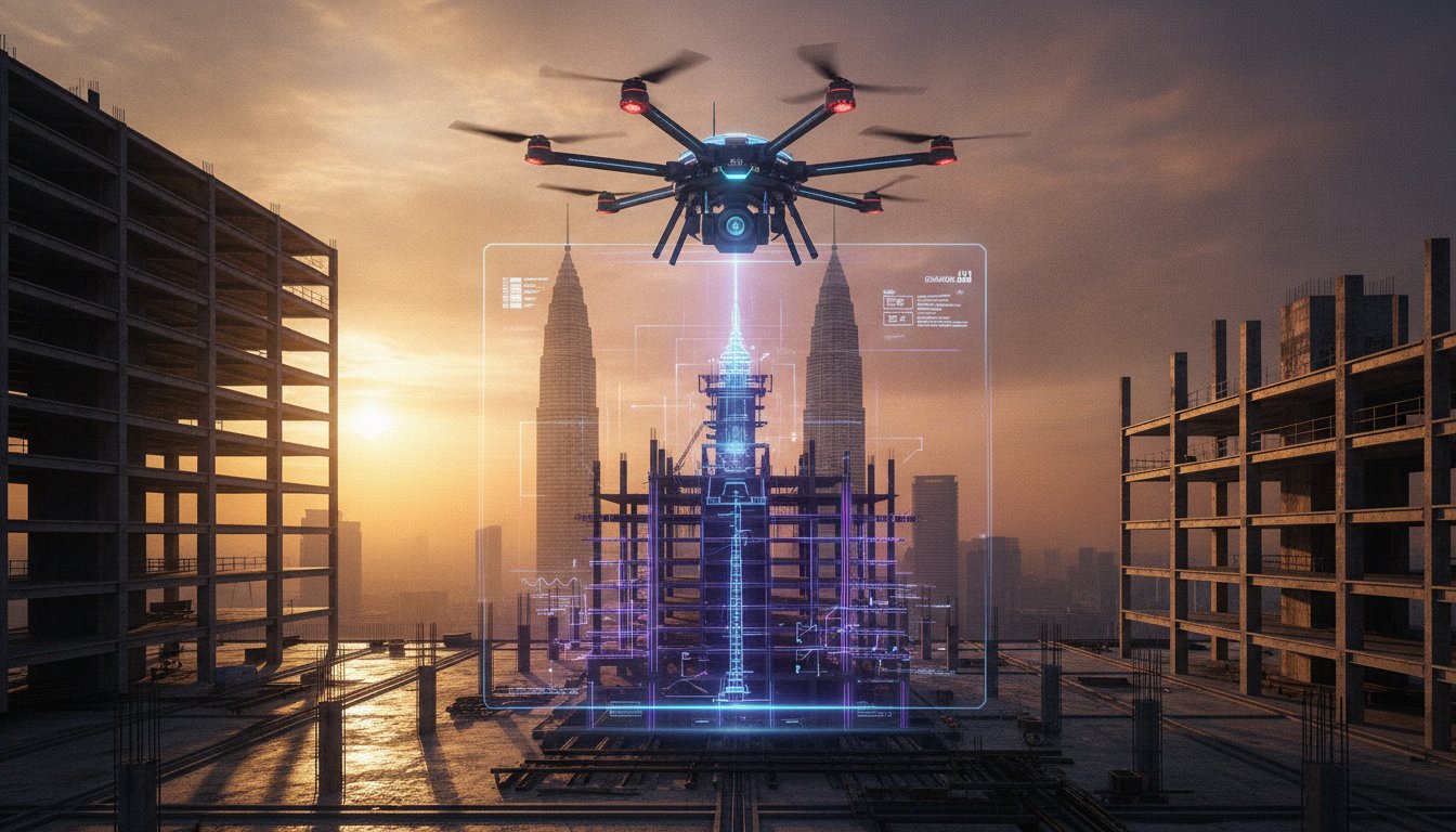
In 2026, a construction site without aerial oversight isn't just behind the curve; it's operating in the dark. You know the friction of managing sprawling, multi-site infrastructure where static reports fail to capture the full scope of progress. Stakeholder misalignment isn't just an inconvenience. It's a risk to your timeline; it's a threat to your budget. Integrating professional drone footage construction Malaysia into your workflow bridges this gap. It turns raw site data into a clear, strategic narrative for a sector now valued at RM 178.6 billion.
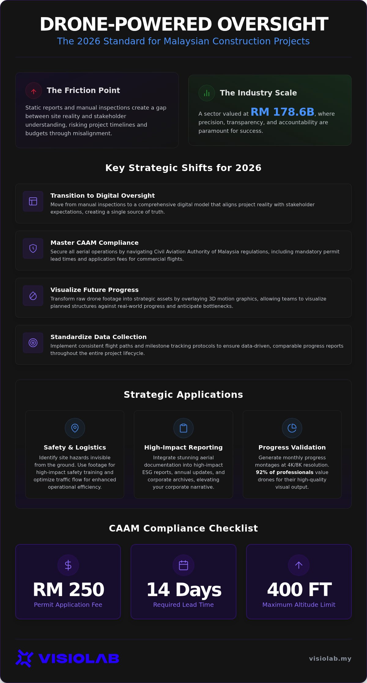
Discover how strategic drone visuals transform progress tracking into a high-impact communication and management tool for your next project. We will explore the RM 250 CAAM permit process, the 14-day lead times, and how to capture high-impact visuals for your ESG and annual reports. From maintaining the 400-foot altitude limit to delivering actionable data for project meetings, this guide ensures your oversight is as sophisticated as the structures you build. Master the bridge between site reality and boardroom strategy with precision and purpose.
• Transition from manual site inspections to a digital oversight model that aligns project reality with stakeholder expectations.
• Secure your operations by mastering CAAM compliance, including the 14-day permit lead times and RM 250 application fees required for commercial flights.
• Transform raw drone footage construction Malaysia into strategic assets using 3D motion graphics to visualize planned structures against real-world progress.
• Implement standardized flight paths and milestone tracking to ensure consistent, data-driven comparisons throughout the project lifecycle.
• Elevate your corporate narrative by integrating aerial documentation into high-impact ESG reports and annual stakeholder updates.
Strategic documentation isn't a luxury. It's a requirement. In the high-stakes environment of Malaysian infrastructure, drone footage construction Malaysia serves as the bridge between site reality and boardroom strategy. We're moving away from manual site walks that take hours and provide only fragmented glimpses of progress. Digital aerial oversight offers a comprehensive, real-time view. It's about precision. It's about accountability. Malaysian GLCs and MNCs are increasingly mandating these visuals for 2026 projects to ensure transparency in high-value national contracts. They need to see results, not just hear about them. This transition from passive observation to active documentation is the new industry baseline.
High-resolution visuals do more than impress; they inform. When every stakeholder sees the same bird's-eye view, you establish a "single source of truth." This clarity eliminates the misalignment often found in traditional reporting. By integrating these shots with a construction progress video Malaysia guide, project managers can document every phase with forensic detail. This level of transparency is essential for modern drone applications in construction; it builds a psychological foundation of trust. Seeing a RM 500 million project rise week-by-week via clear visuals provides a confidence that spreadsheets simply can't match. It transforms a complex site into a readable map of milestones.
The standard for documentation has shifted. As of 2026, major government tenders and GLC-led projects mandate high-fidelity visual reporting. It's no longer enough to submit a few grainy photos. 4K and 8K resolutions are now the baseline for industrial documentation in Malaysia. This isn't just about resolution; it's about the "Visionary Architecture" of the report itself. Professional drone footage construction Malaysia allows for the overlay of 3D models onto actual site progress. This helps teams anticipate bottlenecks before they happen. It's a proactive approach to project storytelling that resonates with investors and public stakeholders alike. If you're bidding for national-scale infrastructure, your documentation must reflect the sophistication of your engineering. It's about presenting a future-ready image that matches the RM 178.6 billion growth of our construction sector.
Raw data is a burden. Strategic insight is a catalyst. In the context of 2026 infrastructure development, drone footage construction Malaysia acts as a bridge between the physical site and the digital boardroom. We don't just capture clips; we curate narratives. Monthly progress montages transform gigabytes of data into concise, high-impact updates that keep stakeholders aligned. This is why 92% of construction professionals nationwide now value drones for their high-quality visual output. By integrating 3D motion graphics, we overlay planned structures onto real-world footage. It allows you to see the finish line while you're still in the trenches.
The true power of aerial documentation lies in its synergy with other tools. While a long-term timelapse provides the steady pulse of a project, drone visuals offer the detailed check-up. This combination creates a comprehensive project legacy that is invaluable for annual reports and corporate archives. It ensures that when you look back at a RM 200 million project, you have a complete, high-fidelity record of every critical milestone. To see how this fits into your overall strategy, consider exploring our construction documentation services.
Transparency is the new currency for Malaysian GLCs. Drones provide undeniable proof of environmental compliance. They allow you to visualize site rehabilitation and green initiatives from a perspective that ground-level photos cannot reach. Whether you're monitoring silt traps or documenting the preservation of local flora, aerial views offer a clear record of your commitment to sustainability. Linking these visuals to ESG video production Malaysia turns technical compliance into a powerful storytelling tool for investors and regulatory bodies.
Safety is a culture, not just a checklist. Aerial oversight identifies site hazards that remain invisible from the ground, such as improper material stacking or logistics bottlenecks. You can use this footage to create high-impact safety induction videos that feature the actual site workers will navigate. Visualizing traffic flow and heavy machinery movement from 400 feet up allows for safer site management and more efficient logistics planning. It's a proactive approach that reduces risk while enhancing operational fluency across the entire project lifecycle.
Compliance isn't a bureaucratic hurdle. It's the bedrock of project integrity. When you're capturing drone footage construction Malaysia, operating within the Civil Aviation Authority of Malaysia (CAAM) framework is the only way to protect your brand and your site. The legal stakes are high. Corporations operating without proper certification face fines up to RM 100,000. For individuals, the penalty can reach RM 50,000 or three years of imprisonment. These aren't just numbers. They're risks that can derail a multi-million ringgit infrastructure project in an instant. Professional oversight ensures that every flight is authorized, every pilot is certified, and every risk is mitigated. It's about moving from a "can we fly" mindset to a "how we fly safely" strategy.
Obtaining an Authorization to Fly (ATF) permit requires foresight. You must submit your application to CAAM at least 14 working days before your scheduled flight date. Each application for drones under 20kg carries a RM 250 fee. For larger equipment over 20kg, the fee increases to RM 1,000. This timeline is critical. If your project hits a major milestone on the 25th, your paperwork needs to be in by the 11th. Unlicensed operators often skip these steps to save time, but they expose GLCs and MNCs to massive liability. A visionary partner handles this administrative burden for you. They ensure your documentation is as robust as your engineering, allowing you to focus on the build while we handle the sky.
Active construction zones are complex environments. Safety isn't optional. Every commercial pilot must hold a Remote Pilot Certificate of Competency (RCoC-B), a certification that typically costs between RM 2,000 and RM 3,500. This ensures they understand the 400-foot (120-meter) altitude limit and emergency protocols. During filming, we implement strict Standard Operating Procedures (SOPs). This includes equipment redundancy and site-specific safety briefings. We coordinate directly with site managers to manage privacy and security concerns, especially in high-density or sensitive project areas. It's about maintaining a clear perspective without compromising site security. Your visual communication agency should act as a safety officer in the sky, providing clarity without adding chaos. This professional approach turns a potential hazard into a disciplined data-gathering mission.
Automation serves the strategy; it doesn't replace it. To extract maximum value from drone footage construction Malaysia, your workflow must be systematic and repeatable. It's the difference between a random collection of clips and a coherent chronological record. We establish precise GPS-locked flight paths to ensure that every month, the camera sees exactly what it saw before. This allows stakeholders to visualize progress with scientific accuracy. We don't just fly; we coordinate with site engineers to capture critical milestones like foundation completion or heavy machinery mobilization. This ensures your documentation reflects the true pulse of the site. It's about auditing the build through a lens of editorial clarity.
Managing the resulting data is a high-stakes task. A single project can generate terabytes of high-resolution 4K and 8K footage. We implement robust data management protocols to ensure this information is indexed, secure, and accessible. You don't need raw files; you need answers. By organizing footage by date and milestone, we turn a mountain of data into a searchable library of project truth. This organized approach is essential for large-scale Malaysian infrastructure where accountability is paramount.
Scheduling for strategic impact means looking beyond the construction calendar. We align our flights with your board meetings and quarterly reporting cycles. This ensures your visuals are always current and relevant for your most important presentations. We prioritize the "golden hour"-that narrow window of soft light-to elevate the footage for high-end corporate use. In Malaysia's unpredictable climate, we manage weather risks by maintaining flexible 48-hour standby windows. This proactive approach ensures that even during monsoon seasons, your reporting remains uninterrupted and professional. We don't let a tropical downpour derail your stakeholder updates.
The transition from raw data to a strategic narrative happens in the edit suite. We apply advanced stabilization and color grading to ensure every frame reflects your brand's quality. We use 2D and 3D overlays to label zones and call out specific achievements. This editorial clarity is vital for translating complex site activities into digestible insights for non-technical stakeholders. While we deliver quick-turnaround clips for immediate press needs, we also manage the long-term archiving of your project's digital twin. This creates a lasting brand legacy that can be repurposed for years to come. Build a record that stands the test of time. Start your strategic construction documentation today.
In a construction market valued at RM 178.6 billion, having the best hardware is only half the battle. The other half is having the vision to use it effectively. VISIOLAB isn't just an operator; we're a strategic partner for Malaysia’s most ambitious GLCs and MNCs. While others provide raw files, we provide clarity. We align every frame of our drone footage construction Malaysia with your organizational goals. This is the "Strategic Video" difference. We don't just show a site; we tell the story of your progress, your commitment to safety, and your ESG impact. Our comprehensive suite integrates drone oversight with long-term timelapse and safety training videos. This creates a unified documentation ecosystem that serves every department from engineering to marketing. We translate complex site data into a clear, strategic narrative.
We approach project documentation with the mindset of a "Visionary Architect." This means we understand the technical requirements of a national infrastructure project as deeply as the creative requirements of a corporate montage. We've mastered the bridge between abstract strategy and tangible results. By combining technical drone mastery with high-level storytelling, we transform complex infrastructure messages into clear visual content. Whether you're managing a multi-year bridge build or a new industrial park, we deliver the perspective needed to keep stakeholders aligned. Our expertise in 2D and 3D motion graphics allows us to overlay progress data directly onto the visuals. It's not just a video; it's a visual dashboard for your project's success. We ensure your documentation is as sophisticated as your engineering.
National infrastructure projects require a partner who understands the weight of the legacy being built. We customize our documentation packages to fit the specific needs of multi-year builds. We offer more than just a service; we offer a strategic consultation to ensure your project's narrative is as strong as its foundation. From managing the administrative burden of CAAM compliance to delivering 8K resolution masters for your annual reports, we handle the complexity so you can focus on the construction. It's time to move beyond basic aerial photography and embrace a visionary perspective. Partner with Malaysia’s leading strategic video agency today to redefine how you track, report, and celebrate your construction milestones. We're ready to translate your complex requirements into clear, impactful results. Let's build your project's legacy together.
The landscape of Malaysian construction has shifted. Success in 2026 requires more than engineering excellence; it demands visual clarity and regulatory precision. By integrating professional drone footage construction Malaysia into your workflow, you bridge the gap between complex site operations and high-level stakeholder reporting. You move from simply capturing images to generating strategic data that drives project confidence. This transition ensures that your documentation is as robust as your engineering.
Adhering to CAAM regulations is no longer just a legal requirement. It's a hallmark of professional integrity that protects your project's reputation. As you align aerial oversight with your ESG goals and reporting cycles, you create a legacy of transparency and technical mastery. VISIOLAB stands ready as your "Visionary Architect" in this journey. Trusted by Malaysian GLCs and MNCs, we bring full CAAM compliance and industrial safety expertise to every flight, redefining corporate video production with strategic clarity.
Transform your construction progress into a strategic visual asset with VISIOLAB. Your project deserves a perspective as ambitious as its design. Let's build that vision together.
Yes, you must obtain an Authorization to Fly (ATF) permit from the Civil Aviation Authority of Malaysia (CAAM) for any commercial drone activity. This requirement applies regardless of the drone's weight or the size of your site. Applications require a 14-working-day lead time for processing. Operating without this permit exposes your organization to significant legal liabilities and potential fines. Professional documentation services manage this administrative process to ensure your site remains compliant and secure.
Monthly captures are the industry standard for consistent progress tracking. However, we recommend aligning flights with specific project milestones such as foundation completion, structural topping out, or major logistics shifts. This frequency ensures you have a reliable chronological record for stakeholder meetings and annual reports. Regular intervals allow for accurate month-over-month comparisons, turning raw site data into a clear narrative of project momentum and engineering success.
High-resolution aerial data is a foundational asset for 3D mapping and Building Information Modeling (BIM) integration. Through photogrammetry, we convert drone footage construction Malaysia into accurate 3D models or point clouds. This digital twin allows engineers to compare planned designs against actual site conditions. It provides a level of technical precision that ground-level inspections cannot match, facilitating better clash detection and more efficient resource allocation across the project lifecycle.
Using an unlicensed operator carries severe legal and financial risks for your project. In Malaysia, individuals can face fines up to RM 50,000 or three years of imprisonment; corporations can be fined up to RM 100,000. Beyond legal penalties, unlicensed flights typically void site insurance policies. If an accident occurs, your organization bears the full liability for damages. Professional, licensed operators provide the necessary certification and public liability insurance to protect your project and brand.
Aerial footage and long-term timelapse create a synergistic documentation ecosystem. While a fixed-position timelapse captures the steady pulse of construction over years, drones provide a mobile, high-detail perspective of specific zones. Integrating these two formats allows you to transition from broad structural overviews to intimate site details in your final project documentary. This combination offers stakeholders a comprehensive visual record that is both technically precise and emotionally engaging for corporate storytelling.
We typically deliver "Quick-Turnaround" clips for social media or internal updates within 48 to 72 hours of the flight. For more complex monthly progress montages that include color grading, 3D overlays, and stabilization, the standard turnaround is 7 to 10 working days. This timeline ensures that the final output meets high-end corporate standards while remaining relevant to your current reporting cycle. We prioritize speed without sacrificing the editorial clarity your stakeholders expect.
Aerial visuals are essential for Environmental, Social, and Governance (ESG) reporting. They provide undeniable visual proof of environmental mitigation efforts, such as silt trap maintenance or green buffer preservation. Using drones to document site rehabilitation offers a level of transparency that ground photos cannot achieve. This data-driven imagery helps Malaysian GLCs and MNCs communicate their commitment to sustainability to investors and regulatory bodies, turning technical compliance into a powerful brand asset.
If your site is within a Restricted Area or "No Fly Zone," such as near an airport or government building, special CAAM authorization is required. This process is more rigorous and may involve coordination with the Royal Malaysian Air Force or local security agencies. We handle these complex negotiations on your behalf, ensuring all security protocols are met. While it may extend the planning phase, we ensure your project documentation proceeds legally and safely without compromising site security.
Let’s create and collaborate
We’re versatile multitaskers, and we thrive on a lot of projects. You've seen a few of our works that we are most proud of, and your project could be next in line.

Empowering brands with captivating visual stories, creating strong connections and growth.
