
What if your multi-year construction data wasn't just a digital paper trail, but a strategic engine for national-scale influence? You already know that managing a massive project is a complex balancing act of precision and perception. It's often frustrating when critical engineering milestones get l...
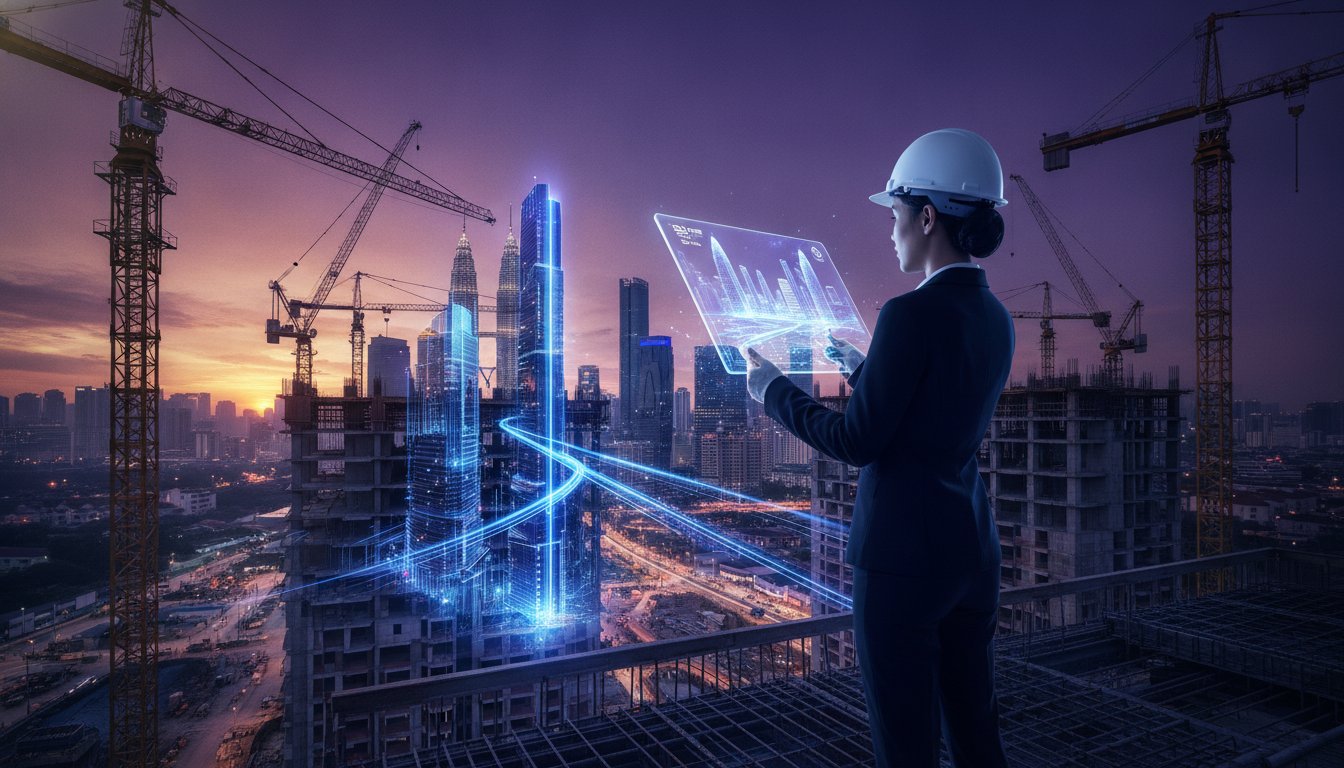
What if your multi-year construction data wasn't just a digital paper trail, but a strategic engine for national-scale influence? You already know that managing a massive project is a complex balancing act of precision and perception. It's often frustrating when critical engineering milestones get lost in translation; it's even worse when fragmented documentation fails to tell a cohesive story to your board or non-technical stakeholders. With construction costs projected to rise by up to 15% for new tenders in late 2026, the need for absolute clarity has never been more urgent.
This guide shows you how to transform an infrastructure project timelapse KL strategy into a sophisticated narrative asset. You'll discover how to bridge the gap between operations and marketing, ensuring your site progress becomes a reliable record for audits and a high-impact tool for ESG reporting. We will explore the technical requirements for remote visibility: from navigating CAAM drone regulations to securing multi-year data against loss. It's time to move beyond passive recording and start building a visionary record of your project's legacy.
• Learn how to bridge the gap between engineering reality and stakeholder perception through high-resolution, long-duration visual records.
• Deploy a resilient infrastructure project timelapse KL framework that utilizes solar-powered hardware and 5G connectivity for seamless remote visibility.
• Transform raw operational data into high-impact assets for ESG reporting, proving your project's environmental and social commitment to national stakeholders.
• Master the pre-production discipline required to identify core messaging and site stability before a single camera is ever mounted.
Infrastructure documentation has evolved. It's no longer just an operational checkbox; it's a sophisticated strategic asset. A high-resolution, long-duration visual record serves as more than a simple archive. It's a testament to engineering precision. By utilizing Time-lapse photography, you can compress years of complex construction into a few minutes of undeniable progress. For national-scale works, a strategic infrastructure project timelapse KL framework ensures every milestone is captured with absolute intentionality. It creates a bridge between technical site realities and the visionary expectations of the boardroom.
Accountability is the bedrock of multi-phase infrastructure. When site milestones are linked to national development goals, the pressure to perform is constant. Time-stamped visual proof provides the necessary evidence that schedules are being met. It eliminates ambiguity. It fosters a culture of discipline. By aligning visual data with strategic objectives, you transform raw footage into a tool for national-scale storytelling. Implementing an infrastructure project timelapse KL approach allows you to secure your brand legacy while maintaining rigorous project oversight.
Transparency isn't just a value; it's a currency in the public sector. When working with government bodies and GLCs, the ability to provide verifiable records builds immense trust. Visual documentation supports public-facing updates and ensures clarity for non-technical decision-makers. They don't need to interpret dense engineering reports to see that a project is on track. Instead, they can witness the transformation. This level of clarity is vital for regulatory compliance and ensures the project narrative remains under your control, backed by hard visual data.
The value of a strategic timelapse delivers tangible operational returns. High-quality remote visibility reduces the frequency of physical site visits, saving time for senior management. If a contractor dispute arises, your time-stamped archive serves as an objective witness to resolve issues quickly. These records also build a high-value library of assets for future infrastructure bids. By showcasing a track record of disciplined execution, you position your firm as a reliable partner for future national growth. It's an investment in both present efficiency and future legacy.
Precision is the language of infrastructure. Capturing a massive Strategic Infrastructure Project requires more than just a camera; it demands an ecosystem of reliability. An effective infrastructure project timelapse KL setup starts with hardware that survives. Weather-resistant housing protects high-resolution sensors from tropical humidity and intense heat. Solar-powered systems provide autonomous energy, ensuring that multi-year deployments never miss a frame due to power fluctuations. This mechanical resilience is the first step in creating a flawless visual record.
Connectivity is the next pillar of site oversight. High-speed 4G or 5G remote access allows for real-time progress monitoring from any location. Resolution matters here. While standard definition might suffice for small sites, national-scale projects demand 4K or 8K clarity. This level of detail allows engineers to zoom into specific structural joints or material placements without losing definition. Strategic placement is equally vital. We map camera angles to ensure that every critical engineering milestone is visible, documented, and ready for review. You can see how Construction Progress documentation provides this level of site-wide clarity.
Static footage only tells half the story. Integrating 3D motion graphics allows you to visualize the invisible. By layering digital models over real-world progress, you can show planned structures before they're physically present. This is especially powerful for explaining sub-surface work or complex internal engineering that traditional cameras can't reach. 3D motion graphics transform abstract technical plans into a clear, unified vision of the project's final scope.
Fixed cameras offer consistency, but drones provide perspective. Executing an infrastructure project timelapse KL strategy requires a dual focus on fixed and mobile assets. Scheduled aerial progress photography captures large-scale site changes that ground-level cameras might miss. This aerial mapping is essential for tracking earthworks and massive structural footprints. Safety and compliance are paramount in this process. In Malaysia, CAAM regulations require all commercial drones to stay below a maximum altitude of 120 meters. Violations can lead to corporate fines of up to RM100,000. Professional aerial documentation ensures your project remains compliant while delivering a comprehensive, multi-angle view of every phase.
Data is just noise without a narrative. While operational monitoring focuses on the "what" and "when," strategic communication focuses on the "why" and the "impact." A robust infrastructure project timelapse KL deployment generates millions of data points over several years. If left as raw files, this information is a dormant resource. When curated, it becomes a high-impact strategic asset. It's the difference between a site log and a legacy film. You don't just want to track progress; you want to prove your project's worth to the nation.
Stakeholders aren't engineers. They don't always grasp the complexity of a multi-phase structural deployment through spreadsheets alone. They need a perspective that simplifies. By transforming technical data into a visual story, you bridge the gap between site reality and boardroom expectations. This is especially critical for high-stakes presentations like annual general meetings. A three-minute montage of a three-year project delivers more clarity than a hundred-page report. It builds anticipation. It validates investment. It secures trust.
The Ekonomi MADANI framework prioritizes long-term economic resilience and sustainability. For GLCs and government sectors, proving environmental impact is no longer optional. It's a requirement. Using an ESG Video Production Malaysia approach allows you to document green building initiatives as they happen. You can show site rehabilitation or the installation of energy-efficient systems in a time-condensed format. This provides undeniable proof of your commitment to social and environmental goals. It turns your construction site into a showcase for national progress.
The transition from raw footage to a strategic film requires editorial discipline. It's about selecting the key frames that highlight human ingenuity and structural triumph. Managing the final stages of a project requires Engineering Precision in both site execution and story curation. We focus on pacing and sound design to elevate technical footage into an emotional journey. These multi-purpose assets are designed for versatility. A single infrastructure project timelapse KL archive can produce content for web updates, social media teasers, and high-stakes launching videos. You're not just recording history; you're directing it.
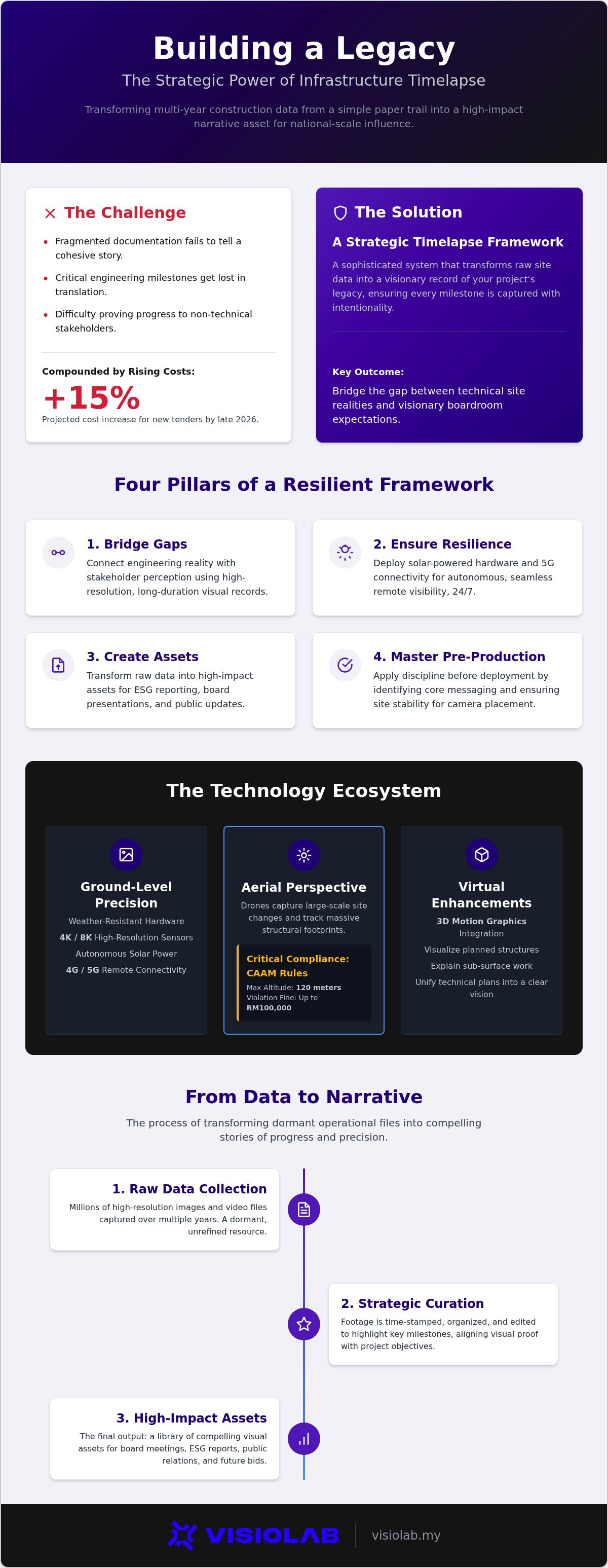
Successful deployment is the intersection of foresight and technical rigor. It requires a blueprint that accounts for years of environmental and structural shifts. When initiating an infrastructure project timelapse KL strategy, your first step is pre-production clarity. You must identify the core narrative before a single camera is mounted. Is the goal to showcase engineering complexity, or is it to document the project's integration into the national landscape? This decision dictates camera placement, frequency of capture, and the final editorial tone.
Site surveys provide the grounding for this vision. We assess structural stability to ensure cameras don't shift during multi-year deployments. Power and connectivity are non-negotiable. While solar-powered systems provide autonomy, they must be positioned to maximize efficiency in specific light conditions. Maintenance is the silent guardian of quality. Periodic checks ensure lens clarity and system health, preventing the risk of data loss or degraded image quality over long durations. Your documentation is only as strong as its weakest frame. By adhering to these standards, you ensure your infrastructure project timelapse KL archive remains a high-value asset for years to come.
Infrastructure projects aren't static; they grow vertically and expand horizontally. Your camera strategy must adapt. This involves pre-planned repositioning to maintain the correct perspective as the structure rises. Managing battery life and solar efficiency in tropical weather is a constant challenge. Intense heat and heavy rainfall require robust hardware that remains operational 24/7. Consistency is paramount. Maintaining fixed frame rates across years ensures a smooth, professional visual flow in the final montage.
Documentation must never compromise safety. Integration with site protocols and induction requirements is mandatory. Our teams work to minimize disruption to active construction workflows, ensuring that the presence of cameras doesn't hinder progress. Establishing a clear reporting rhythm with the project management office (PMO) ensures that site teams and documentation teams are always in sync. This partnership transforms raw site data into a polished record of achievement.
Ready to secure your project's visual legacy? Explore our Long Term Timelapse solutions today.
Strategy defines our production. Since our founding in 2016, we've focused on bridging the gap between abstract engineering and tangible results. For national-scale projects, an infrastructure project timelapse KL strategy isn't a luxury; it's a necessity for high-level oversight. We specialize in serving GLCs, MNCs, and government sectors, providing the professional sophistication required for large-scale industrial documentation. Our approach is built on discipline. We don't just capture footage; we architect a narrative that aligns with your organizational goals. This ensures every frame serves a purpose.
Complexity requires clarity. Our comprehensive service suite covers every stage of the project lifecycle. From long-term timelapse and construction progress monitoring to immersive virtual experiences, we provide the tools to visualize every milestone. We integrate 2D and 3D motion graphics to simplify procedures that are otherwise invisible to the naked eye. This commitment to visual clarity ensures that your data becomes a strategic asset rather than a forgotten file. We deliver tangible value through a mastery of both creative and technical domains, providing a reliable record for audits and reporting.
Clarity and perspective are the ultimate communication tools. In the context of national development, the ability to translate complex organizational messages into high-impact visuals is transformative. We act as a catalyst for this transformation. By providing a clear perspective on site evolution, we help you communicate success to stakeholders with confidence. You can read more in our Construction Progress Video Malaysia guide. We ensure that your project's story is told with the precision it deserves, aligning site reality with visionary goals.
Every project has a unique heartbeat. We customize our visual solutions to meet your specific requirements, whether you're managing a civil engineering masterpiece or a sprawling industrial facility. Our strategic consultation process starts with understanding your vision. We then deploy the technical rigor needed to capture it perfectly. We ensure that your infrastructure project timelapse KL deployment is resilient and results-driven. Don't leave your project's legacy to chance. Consult with VISIOLAB for your infrastructure documentation needs and start transforming your site data into a high-impact strategic asset today.
The evolution of your site is more than a sequence of frames; it's a testament to engineering excellence and national progress. By integrating a professional infrastructure project timelapse KL framework, you bridge the gap between technical complexity and stakeholder inspiration. You move beyond simple monitoring toward high-impact storytelling that validates your ESG commitments and secures long-term trust. Success on this scale requires a partner who understands the high stakes of government and multinational sectors.
VISIOLAB brings a strategic focus to every deployment, combining technical rigor with advanced 2D and 3D motion graphics to simplify the complex. We're trusted by GLCs and MNCs to transform raw data into a visionary record of achievement. It's time to elevate your documentation from a site log to a strategic asset. Partner with VISIOLAB for Strategic Visual Documentation and ensure your project's story is told with the clarity it deserves. Your milestones are the blueprint for Malaysia's future. Let's capture them with precision.
A construction timelapse project can span the entire lifecycle of a development; often lasting between two to five years or more for national-scale works. We deploy hardware designed for extreme longevity to ensure consistency. This allows every phase, from initial earthworks to the final unveiling, to be captured with precision. Long-term reliability is the core of our approach, providing a complete visual history for future audits and legacy reporting.
High-resolution formats like 4K and 8K provide the necessary clarity to inspect minute engineering details across vast sites. This level of detail allows you to zoom into specific structural elements without losing definition. For an infrastructure project timelapse KL strategy, these resolutions are essential. It's the best way to create high-impact assets that remain sharp on large-scale displays. It ensures your visual documentation meets the professional standards required for board-level presentations and government reports.
We implement a rigorous maintenance schedule that includes periodic physical inspections and lens cleaning to combat site dust and tropical humidity. Remote system health monitoring allows us to detect potential issues before they impact data collection. This proactive discipline ensures that your documentation remains uninterrupted throughout the project's duration. By maintaining hardware health, we protect the integrity of the multi-year visual record and ensure every frame captured is of the highest professional quality.
Yes, timelapse footage is a powerful tool for proving environmental and social impact. You can visually document green building initiatives, site rehabilitation, and the implementation of energy-efficient systems as they happen. This provides undeniable, time-stamped evidence for your ESG reports. It transforms raw progress into a compelling narrative of corporate responsibility, helping you meet the transparency requirements of GLCs and international stakeholders while showcasing your commitment to long-term national sustainability goals.
Operational monitoring focuses on day-to-day site tracking and internal project management needs. In contrast, a strategic infrastructure project timelapse KL approach prioritizes high-level storytelling and stakeholder influence. While operational tools provide raw data, strategic timelapse curates that data into a professional narrative. It bridges the gap between engineering reality and visionary goals, creating assets specifically designed for annual general meetings, public relations, and long-term brand legacy building for massive national infrastructure projects.
We utilize enterprise-grade cloud security protocols and encrypted data transmission to protect all visual assets. For sensitive government or GLC projects, we establish strict access controls to ensure only authorized personnel can view or download the documentation. Our systems are built for multi-year data retention, incorporating redundant backups to prevent any risk of data loss. This technical rigor ensures that your project's history remains secure, private, and fully accessible for future audits or compliance checks.
We frequently integrate 3D motion graphics with real-world timelapse footage to visualize planned structures or internal engineering. This technique allows you to show the final vision of a project before construction is complete. It simplifies complex procedures by layering digital models over actual site progress. This integration is particularly effective for explaining sub-surface works or sophisticated architectural designs to non-technical stakeholders, ensuring the full scope of your project is understood and appreciated.
We deploy autonomous, solar-powered camera systems that operate independently of site infrastructure. These units are equipped with high-capacity battery backups to ensure continuous capture even during periods of low sunlight or heavy tropical rain. This independence allows us to document remote or early-stage sites where grid power is unavailable. It's a reliable documentation solution that doesn't disrupt active construction workflows or require technical support from your on-site engineering teams.
Let’s create and collaborate
We’re versatile multitaskers, and we thrive on a lot of projects. You've seen a few of our works that we are most proud of, and your project could be next in line.

Empowering brands with captivating visual stories, creating strong connections and growth.
